|
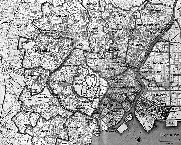
Map of Tokyo, 1892 |
|
As if to align its modern development with "standard" map orientation common among western powers, this map shows the increasing spread and densification of Tokyo. Popular places from the last map (the Nihonbashi, Ginza, Asakusa districts, as well as the Yoshiwara) are identifiable here, but you will note that Shinjuku and Shibuya, two immensely popular business and entertainment districts today, are bare specks on the western outskirts of the city in 1892. Harajuku, a bustling mecca of hip brand name youth fashion and culture isn't even a blip on the screen yet. The location of Asakusa's Ryôunkaku (The Twelve Storeys), which graces the opening page of this web site, is also indicated. Standing about 220 feet high, it was toppled in the Great Kantô Earthquake of 1923 and not rebuilt (see Pop Site 4). |
|
|
