|
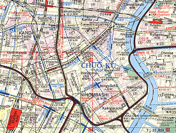
Map of Nihonbashi and Ryôgoku Area, present day |
|
As graphically depicted here, Nihonbashi, the symbolic center of Edo Japan's roadways, has been taken over by a confluence of modern elevated highways that flow over the Kanda River (click it to see photos before and after highway construction). Blue lines represent subways while black-and-white dashes are trains. Tokyo Station is to the west and the old Edo theatre district, centered around Ningyôchô (see PopSite 2), is to the east. Following the Sumida River north you reach Ryôgoku Bridge and train station, which is right next to the Kokugikan, Tokyo's site for sumô tournements (take a look at it). |
|
|